Manicouagan
Manicouagan is a 4x4km map in Squad. It is an overhaul of an earlier map called Manic-5.
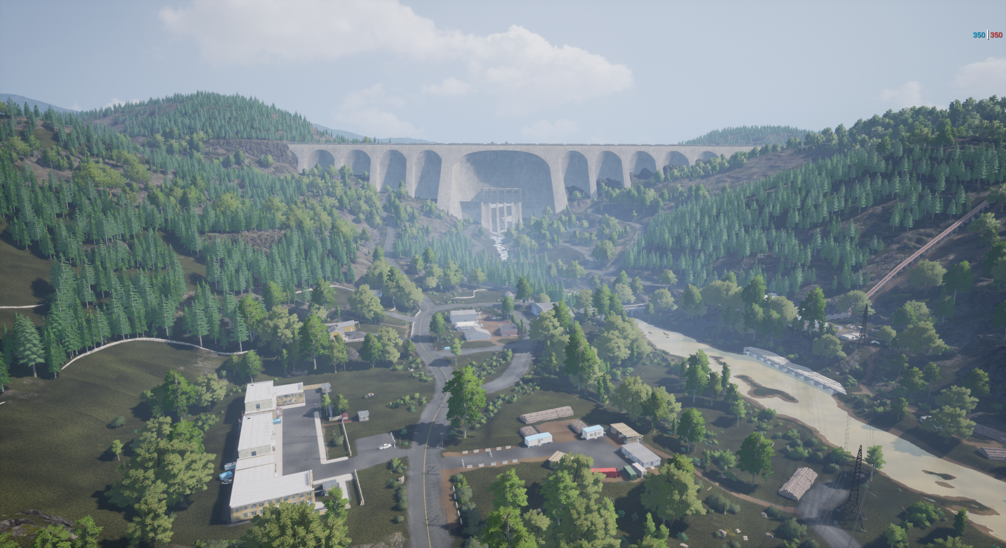
Manic-5 was an experiment with elevation at the time it was created, it featured a very large dam with a deep and narrow valley leading from the dam through the map. However, this led to several design problems:
The steep slopes made vehicle gameplay and map navigation tedious, as going up the vehicles would slow to crawl
The elevated areas around the valley produced powerful overwatch positions that were taken advantage of by vehicles and anti-tank guided missile emplacements
The amount of area that was taken up by slopes, cliffs and elevation changes reduced the amount of approaches players could take to the POIs which resulted in predictable routes, frustrating bottlenecks, and overall limited player choice and freedom - which is a big problem for Squad where we rely on replayability.
My first step was documenting my plan for the overhaul, my goals were:
Reduce texture memory (I had iterated on this map once before and pulled in too many assets from other biomes - this led to unnecessarily poor performance)
Retain the overall design of the map, including some key POIs that players enjoyed (these were also not created by me and it didn’t feel right to throw out someone else’s good work)
Promote amphibious vehicle gameplay (previously we’d done this on maps with large bodies of water, I wanted to experiment with rivers)
Increase the playable area of the map (although the map was 4x4km, all of the elevation, slopes and cliffs made it feel like much less)
Improve the flow between adjacent POIs
Mitigate powerful overwatch positions
Next:
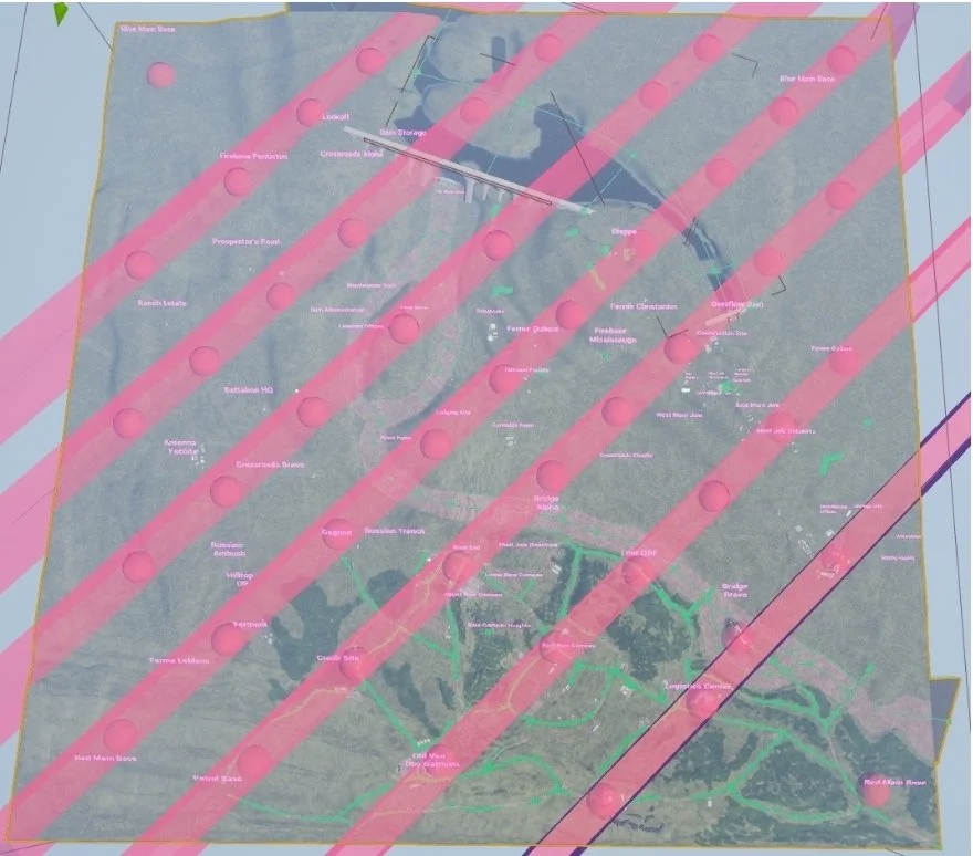
I planned where to move existing or create new POIs to ensure an even distribution across the map.
This ensured we could have multiple lanes (or series of objectives) throughout different areas of the map to ensure a high level of replayability and to help ensure good flow between adjacent POIs.
I then planned where I would put my rivers and river crossings. This was important for several reasons:
There are some factions in the game without amphibious vehicles, so they would need multiple crossings for rivers without being forced into a single bottleneck that the enemy team could take advantage of (to mitigate this further, as the rivers get closer to the edge of the map, the water becomes shallow so it can be moved through by infantry and vehicles, this is indicated to the players by a lighter colored water on the map and vegetation sticking out of the water)
The amphibious water in game doesn’t support rivers that change elevation, so they needed to be flat. The two main rivers and the reservoir above the dam are actually made up of an ocean and two lake volumes.

To increase the amount of playable area, I shrunk the dam reservoir to open up space for more POIs in this area, and also created an abandoned island that would present a challenging POI when a particular lane is chosen.

To address the elevation issues:
The dam's size was reduced to 70% of its original size to reduce its overall height.
The new dam height became the guide for the maximum ‘ceiling’ of elevation in the map.
The bottom of the dam became the guide for the new minimum ‘floor’ of elevation in the map.
The valley in front of the dam was widely expanded into rolling hills to free up more space for POIs and more freedom when it comes to players approaching them


To help mitigate powerful overwatch positions, I employed several techniques:
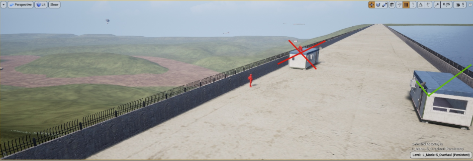
I placed a tall fence atop the dam, this prevented infantry or vehicles from using the dam has a dominating firing position against the valley below
I ensured any buildings or objects at the top o the dam couldn’t be used to get around this
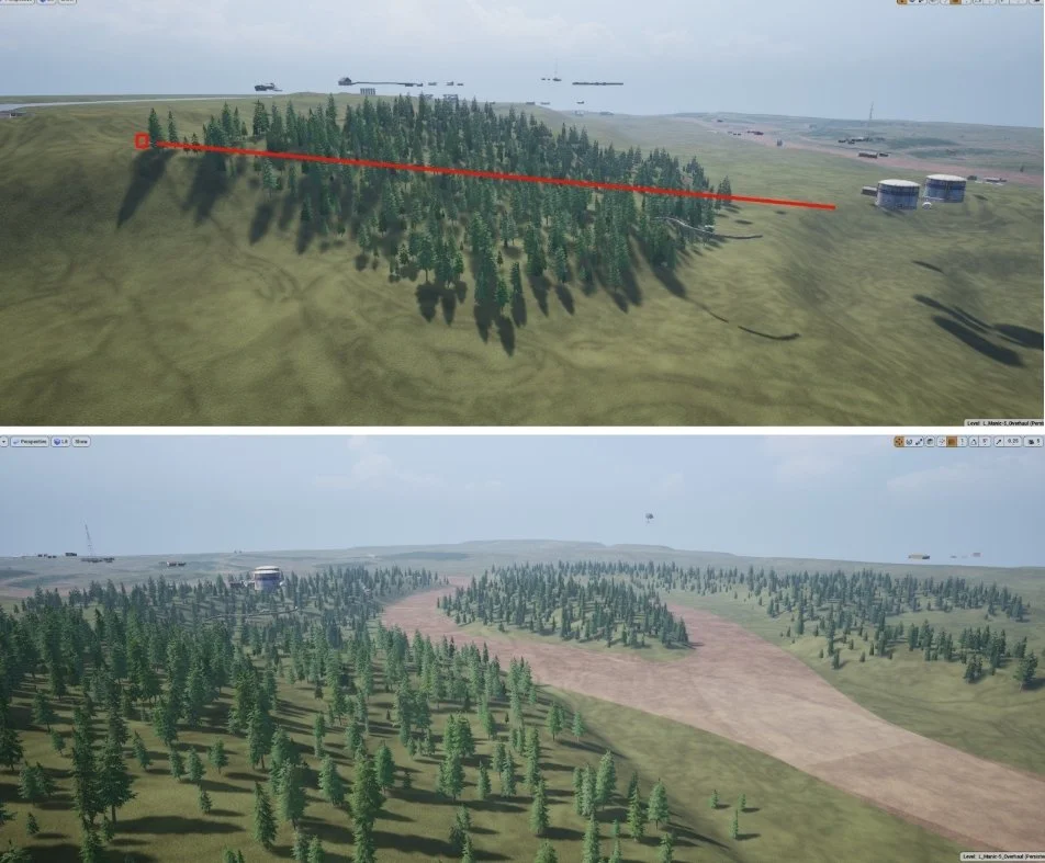
For the elevated highground around the valley, I used gradual slopes with tree cover to reign in powerful overwatch positions
In the valley area, I ensured to include forested hills, islands, and ridgelines to break up sight lines and provide defilade for infantry and vehicles
To help mitigate powerful overwatch positions, I employed several techniques:
I placed a tall fence atop the dam, this prevented infantry or vehicles from using the dam has a dominating firing position against the valley below
I ensured any buildings or objects at the top o the dam couldn’t be used to get around this
For the elevated highground around the valley, I used gradual slopes with tree cover to reign in powerful overwatch positions
In the valley area, I ensured to include forested hills, islands, and ridgelines to break up sight lines and provide defilade for infantry and vehicles

The end result was welcomed as a huge improvement to the original and fixed or mitigated the design issues that were present on the original version of the map.

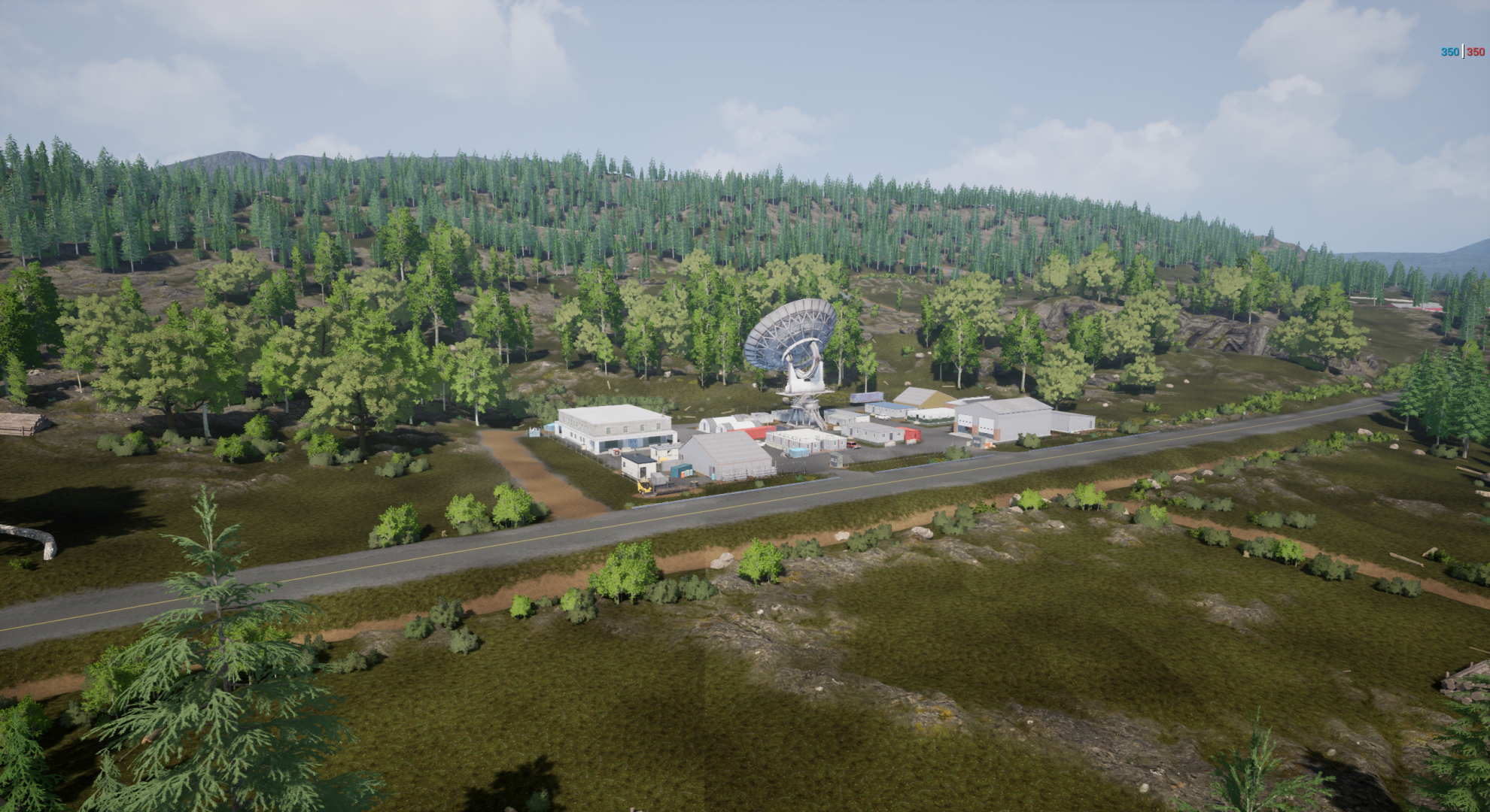
Telecom Facility

Dam Administration
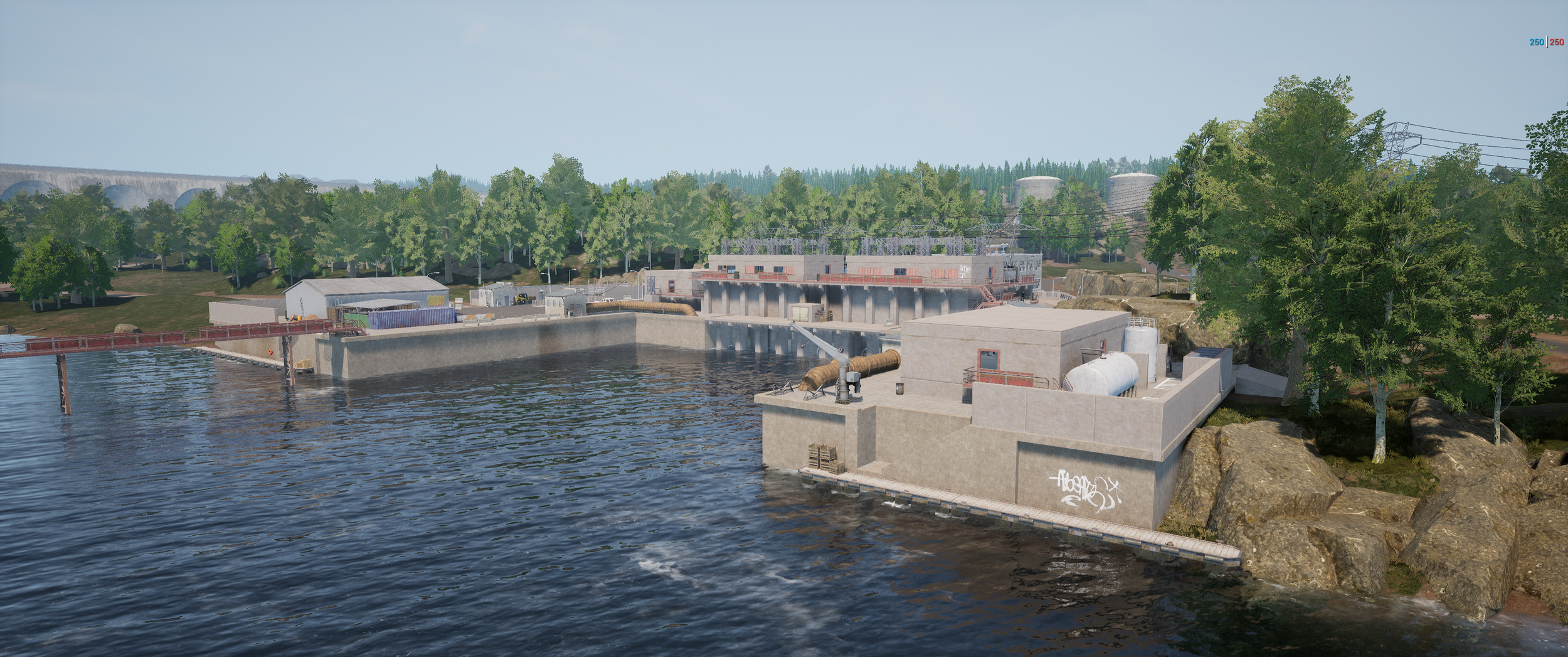
Power Station
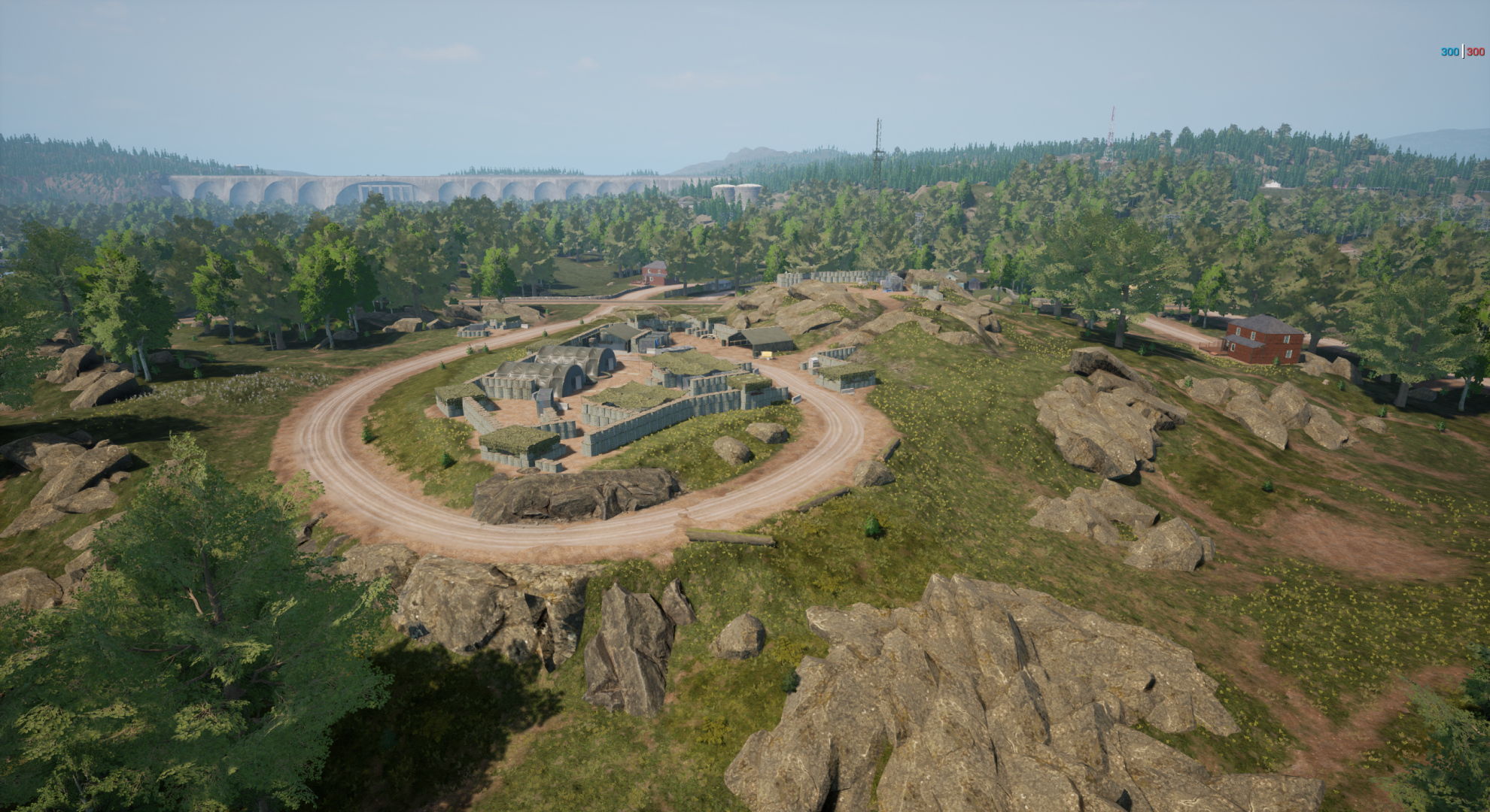
Firebase Boris

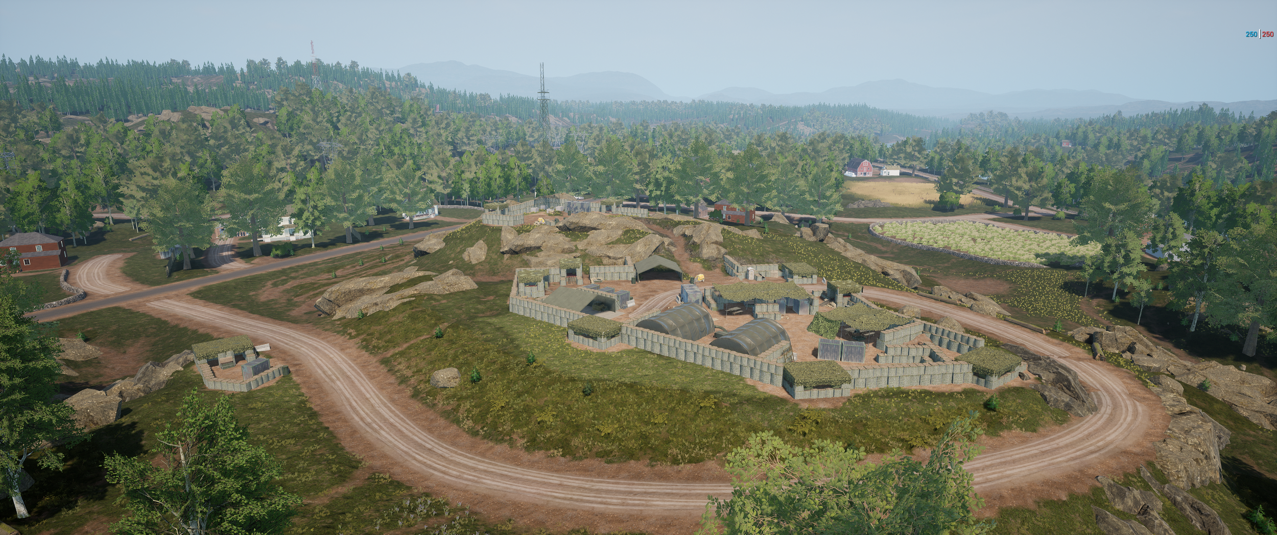
Diefenbunker

Ridgeline Defenses